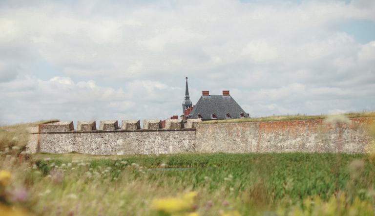
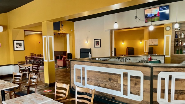
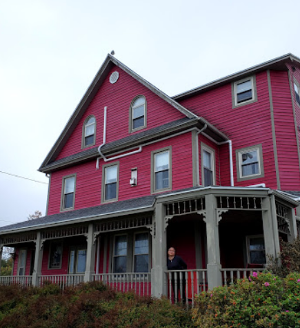
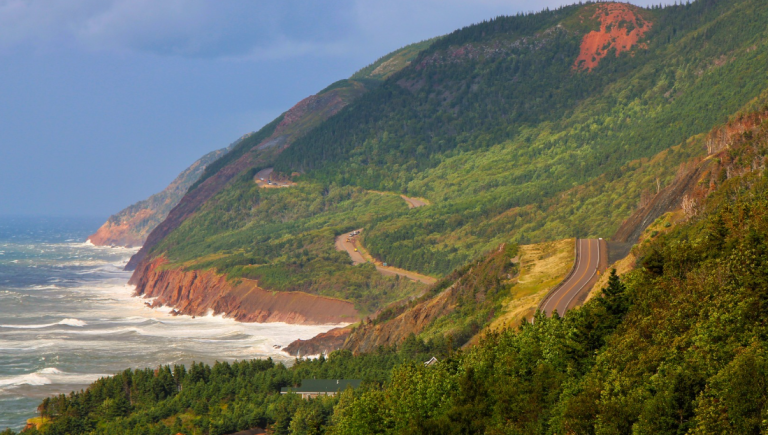
Louisbourg Map – How to Get There

The town of Louisbourg is situated along the east coast of Canada. It is community part of the maritime province of Nova Scotia. To get in, out, and around the town, the main road to track is the Highway 22. Getting to Louisbourg is very easy. Visitors can travel by options via air, sea, or road. If traveling by car, two entry points are available going to the town. The first point is through the Canso Causeway at the Port Hastings. The second point is through the car ferries that travel from the Newfoundland, Argentina, and Port-Aux-Basques going to the terminal of Marine Atlantic in North Sydney. If bus travel is preferred, visitors can avail the service of Acadian Lines. For air travel, Sydney Airport can provide the flight schedule anytime.

The road directions going to Louisbourg include traveling through Nova Scotia mainland, then crossing the Canso Causeway to the Cape Breton Island. From the NS Highway 125 take the exit 8 and route 22 going to Louisbourg. If visitors are coming from the Sydney Airport, they can take the exit 8 nearby, which only takes 30 minutes of driving time. An alternate route is available at the coastal and scenic Marconi Trail. This route is Route 255 from the Glace Bay wherein driving time takes about one hour.

If the visitors will come from the Canso Causeway, take the Route 4 by driving through the TransCanada Highway or Fleur-de-Lis Trail going to Sydney. Visitors can also follow the road directions of TransCanada Highway 105 going to North Sydney through Baddeck, then take the Highway 125 proceeding to Sydney. Nearby Sydney is Exit 8 going to Route 22. Either of the routes will take 2.5 hours of driving time.

Here is a list of travel distances going to Louisbourg:

• Cabot Trail or St. Ann’s – will take about one hour and fifteen minutes
• Canso Causeway – will take about two hours
• Sydney Airport – will take about forty minutes
• Alexander Graham Bell Museum – will take about one and a half hours
• Miner’s Museum – will take about fifty minutes

Here is a list of addresses of places to visit within Louisbourg.
• Fortress of Louisbourg – 259 Park Service Road
• Louisbourg Playhouse – 11 Aberdeen Street
• Lobster Kettle Restaurant – 41 Strathcona Street
• Cranberry Cove Inn – 12 Wolfe Street
• Louisbourg Harbor Inn Bed & Breakfast – 9 Warren Street

Getting or roaming around the town of Louisbourg has some rules of the road. The 100-series highways and TransCanada Highway require for speed of 100-110 kilometers per hour or 62-70 miles per hour. Other highways require for 80 kilometers per hour or 50 miles per hour. At school zones or where children are often visible, the required speed would be 50 kilometers per hour or 30 miles per hour. Travelers must be aware that radar detectors are illegal when traveling to Louisbourg. These will be confiscated by the RCMP. Drivers and all passengers are mandatory to wear seatbelts. For all bicycle and motorcycle riders, helmets are strictly required by the local law. Cars being driven to the mainland of Nova Scotia should have proof of adequate insurance and registration. For motor homes and trailers, the required size limits are 13.6 feet or 4.15 meters in height, 8.6 feet or 2.6 meters in width, and combined 68 feet or 21 meters in length.